|
 Dwight Peck's personal website Dwight Peck's personal website
Mont Tendre in the rain
All the good snow's gone now; there's no help for it -- rain will have to do.
You may not find this terribly rewarding unless you're included here, so this is a good time for casual and random browsers to turn back before they get too caught up in the sweep and majesty of the proceedings and can't let go.
We're just back from Georgia, 9 May 2010, Kristin's gone back to the Land of Milk and Agricultural Hormones, and we're getting a good start on what will subsequently be described as the rainiest May in Swiss recorded history.

Off we go from near the SAC cabane of Cunay near the top of the Rte des Montagnes

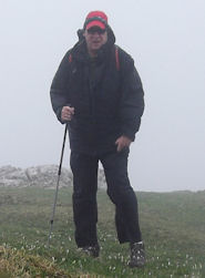
This is a collection of views from a standard afternoon's walk out to our beloved Mont Tendre in the rain, from the top of the Petit Cunay meadows near the Swiss Alpine Club hut, and back again.

This is a splendid marked trail on the Lake Geneva side of the ridgeline. The Chemin des Crêtes long-distance trail is over on the far side, towards France.

Some of our limestone forest floor for which the region is famous

A nasty, bulbous old Tolkien tree

The near end of Mont Tendre seen with the zoom on from the Druchaux meadows, near the l'Aurore cabin.

The same trail, with the Creux d'Enfer de Druchaux torturing its way down to the right.

We're finished with the flower-speckled level approaches and about to start up onto the near end of Mont Tendre.

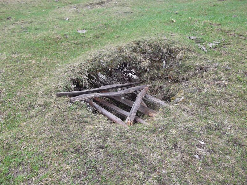
A hole in the meadows -- this is the only karst hole I can think of in the region that's out in the middle of a pasture without a fence round it. Years ago, I saw the tracks of a skier who'd fallen into it and those of his friends trying to haul him or her back out.

Towards the top of Mont Tendre ridge, glistening with drizzly rain and starting to get windy.

Life springs eternal!

More of Mont Tendre from the southwest. The summit is not in sight yet.

A look behind to ensure that we can find our way back if necessary, as recommended in the hiking guides.

Jura shrubbery

The summit appears in the distance.

Leftover cornices swirled about from a long season's snow blowing over from France and the North Atlantic on the far side.

More broken cornice images

Last approaches to Mont Tendre from the southwest. Who knows what this will look like next year?

Wet and bedraggled final steps to the pylon, where as usual the Mont Tendre wind is brutal off the North Atlantic. Hold this scene in memory.
In June (i.e., in a few weeks), according to today's La Côte local paper (25/05/10), the Skyguide airport controllers, Inc., and the Swiss Department of Defense are starting work on a 25-metre radio tower right here at the crown of the Parc jurassien vaudois. The only prominent Vaudois Jura summit without an antenna on top of it. It's a "projet de nature militaire" and so needs no public comment and there is no opportunity for appeal. "Il s'agit d'une priorité nationale". (Americans are very familiar with this crap -- "can't reveal our evidence, it's a matter of national security! You'll just have to take our word for it.").

I'm getting off of here before the wind knocks me over. Actually, the antenna is meant to be redundant before it starts up, "doublée au cas où l'une de nos antennes viendrait à ne plus fonctionner". The Nature Park is a voluntary agreement of all the local towns that own their parts of the mountains here, and the other communes are not pleased that Montricher seems to have gone over to the dark side. There is a movement underway to have this region declared a federal protected area instead of just an environmental agreement amongst the towns, and perhaps that's why our air traffic company has sped things up so abruptly.
[Update late June 2010: after big protests and
a kind of sunny afternoon sit-in at the summit, the authorities
have postponed the antenna for a year and will allow some public
comment.]
[Update 2011: After significant public protests, the government has decided not to build on Mont Tendre after all. That's the good news. The bad news is that they're going to build the thing on the Grand Cunay instead. Mont Tendre's our favorite - Grand Cunay's our second favorite.]

A wet way home

Down to the Chalet de Yens on the French side of Mont Tendre.

The Cabane du Servan, along the Chemin des Crêtes du Jura

Servan

Servan again

The cabane La Pivette, for private ski groups

A little-known unmarked path back through the karsty forest. We're treading warily, because somewhere along the way there are two enormous holes leading down into hell, and we want to not step in them.

A look back at Mont Tendre

The first of the two big holes along this track, with a lot of stuff thrown in to block it up.

The second hole, with logs to keep us out of it.

It's all very obvious now that the snow's off it.

The track through the forest -- preceded by skiers some weeks past.

Pretty drippy and slightly chilly, but it's hard to leave at the end of the afternoon

Last looks and then back to the car

Dieter's been awaiting us faithfully, as always.


 Feedback
and suggestions are welcome if positive, resented if negative, Feedback
and suggestions are welcome if positive, resented if negative,  .
All rights reserved, all wrongs avenged. Posted 25 May 2010, updated 30 March 2011, 26 October 2014. .
All rights reserved, all wrongs avenged. Posted 25 May 2010, updated 30 March 2011, 26 October 2014.
|
 Dwight Peck's personal website


