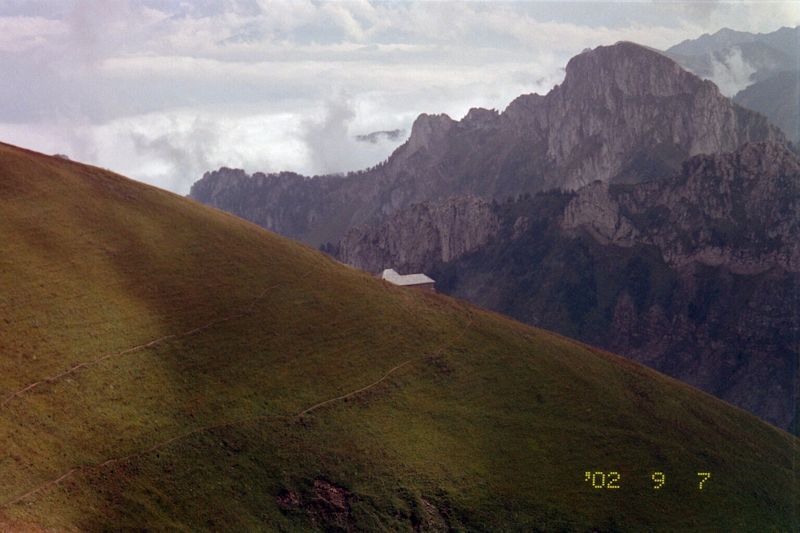
At 2432m,
the Cornettes de Bise is not a very high
mountain but it still
dominates the horizon near Lake Geneva west of the Rhône,
just on the frontier between Switzerland and France.

The Cornettes de Bise from Leysin, March 2014
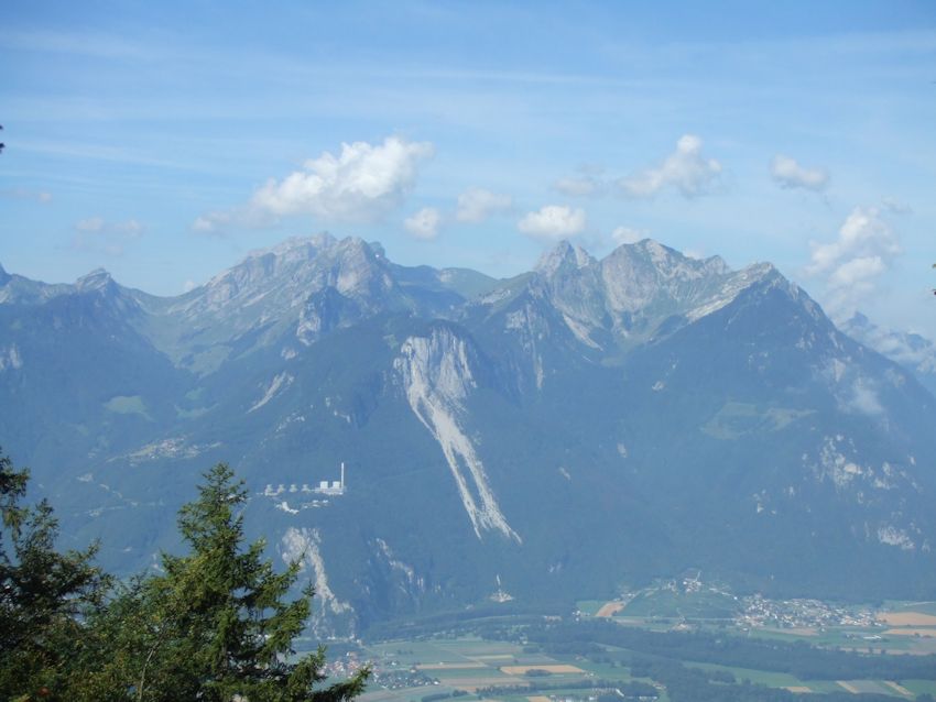
Taken
from the Tunnel de Sarse near Les Agites in the valley of Hongrin, 2006, this
shows the Cornettes de Bise just left of center, Le Grammont to the right, and the valley of the river
Rhône at the bottom flowing towards Lac Léman on the right. The power
plant of Chavalon can be seen perched on the hillside, and Le Flon, the trailhead
on the Swiss side, is above and to the left the power plant.
[Cornettes
de Bise could be translated as something like "horns of the north wind".]
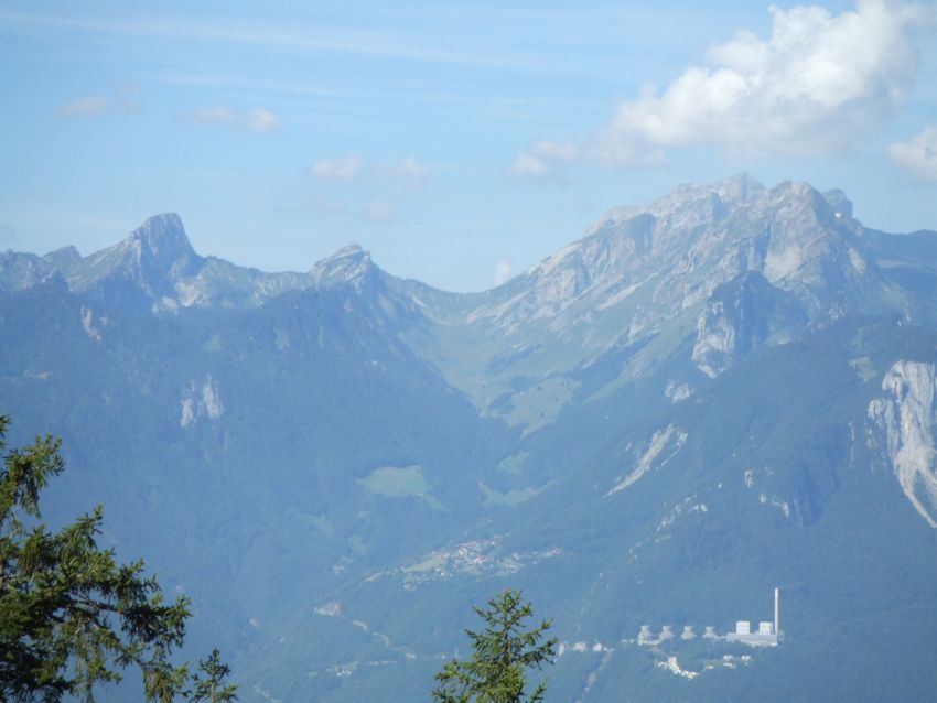
The
Col de Verne is in the centre, with the slope up to La Calaz to the right.
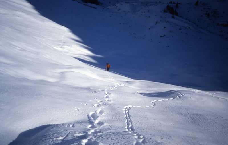
Here,
way back in late November 1986, Dr Pirri slogs towards the Col de Verne . . .
. . . as
his hiking companion entertains him with jeers and rude noises from
above.

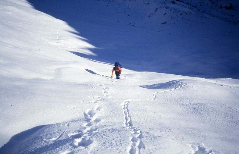
Dr Pirri
continues up the rather steep meadow above the Col de Verne and then . . .
. . . pauses
for reflection, and some lunch, near the farm of La Calaz, with the Cornettes
de Bise peeking down upon him from the top left.
The
narrator soars towards the summit, a beautiful day on 30 November 1986.
The
narrator poses portentously on top very briefly and dashes off down the same track,
trying to get back to La Calaz before Dr Pirri has finished all the sandwiches
-- an unsuccessful dash, as it turned out.

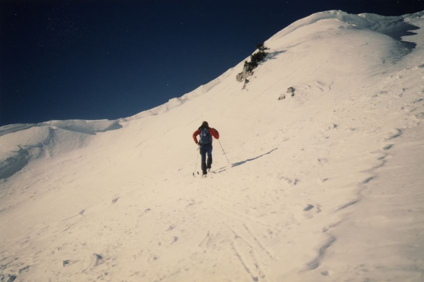
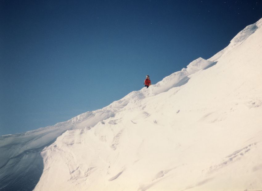
24 January 1987, a ghostly
Prof Larry Ware skis up out of the shadow in the Verne valley towards sunlight
at the Col.
Prof
Ware heads for the Col de Verne, whilst the narrator wishes him luck with the
cornices on the ridgeline.
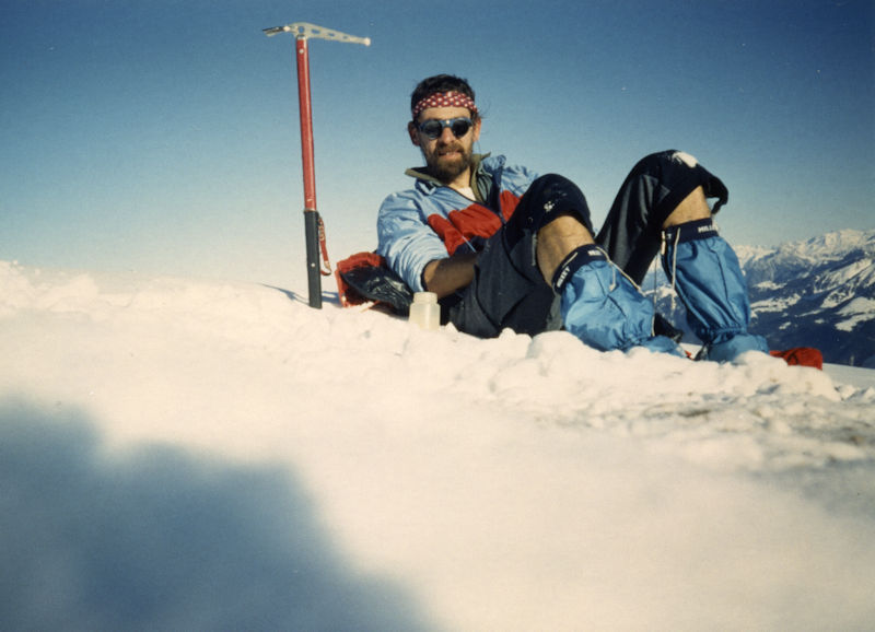
Having
somehow got through the cornices, Mr Larry sneers at the photographer
and breaks out the sandwiches, to get an early lead on lunch.

A hundred
meters above the Col de Verne, the narrator and his companion were confronted
by a big long steep recently-avalanched grassy slope on the way to the Cornettes
de Bise, and decided not to hike up the rest of the way with their silly
little cross-country ski boots. So they went home.
But . . .
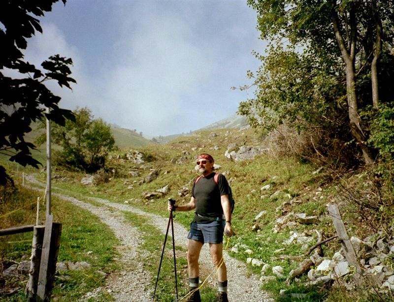
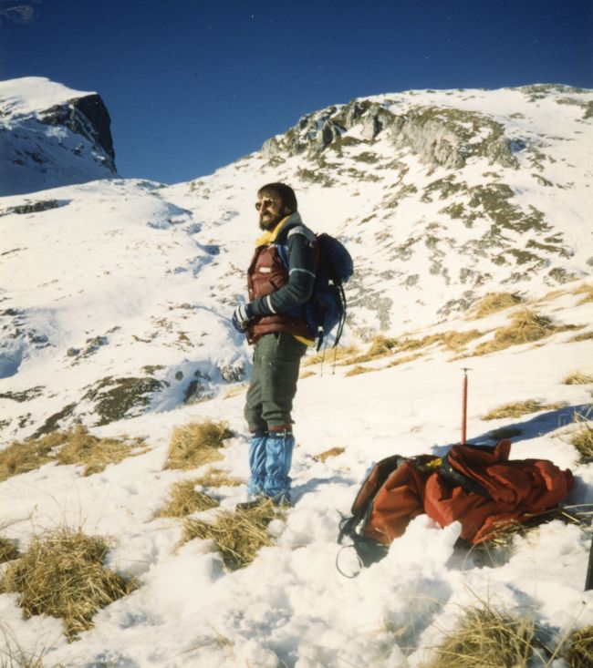
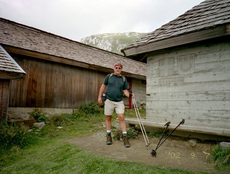
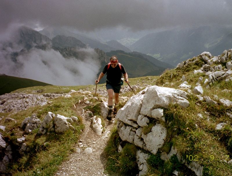
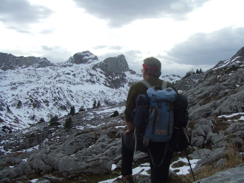
Dr Pirri, in fine form, sets out to get the job done right on 7 September 2002.
Some years have passed, admittedly, since his last assault on this mountain, but determination can be seen etched upon his features.
Just
getting to the Col de Verne these days is enough to make a cautious man begin
to think over his alternatives, especially when the beneficial sun has been playing
hide and seek with us all day.

Getting
semi-near the famous Col de Verne, we glance back eastward at Leysin's Tour d'Aï
immersed in clouds on the far side of the Rhône valley.
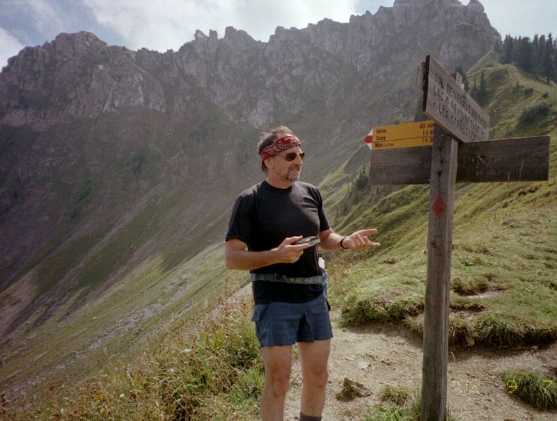
Well,
Aww-right! The Col de Verne, and Prof Pirri, September 2002.

And,
from the Col de Verne, the Cornettes de Bise summit dead center, and the long
grass slope up to La Calaz on the right . . .

Right
up there, the little farm building of La Calaz on the horizon, so near and yet
so far. Half an hour in 2002, 11 minutes in 1992, and that's ageing in a nutshell.

From
the Col de Verne, that's France.
CORNETTES
DE BISE
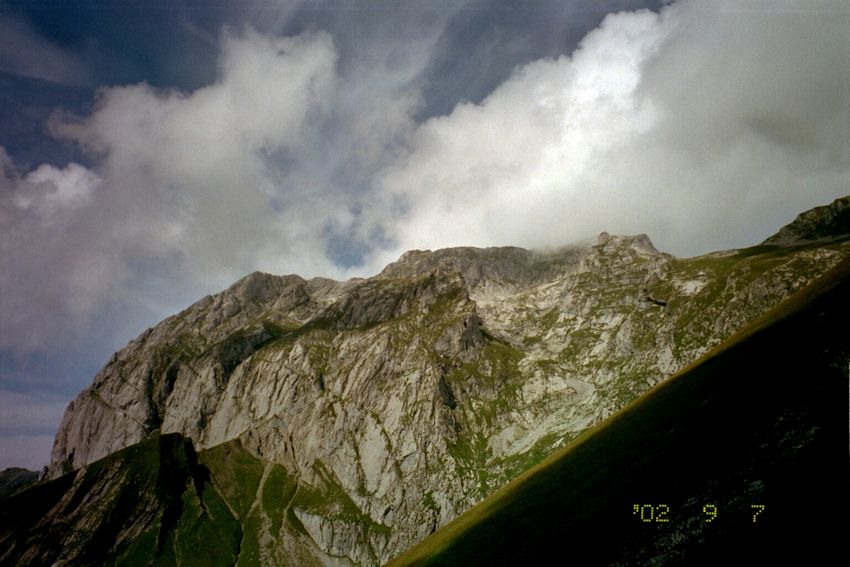
That's
the big pile in its southeastern entirety, a nice big rocky experience. According
to the maps there's another path to the summit just behind that buttress on the
far left. Could well be true.
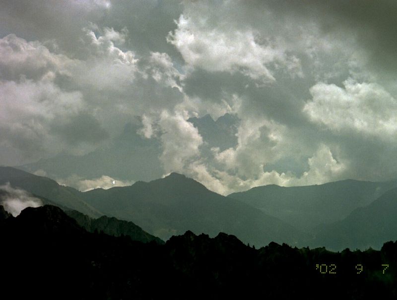
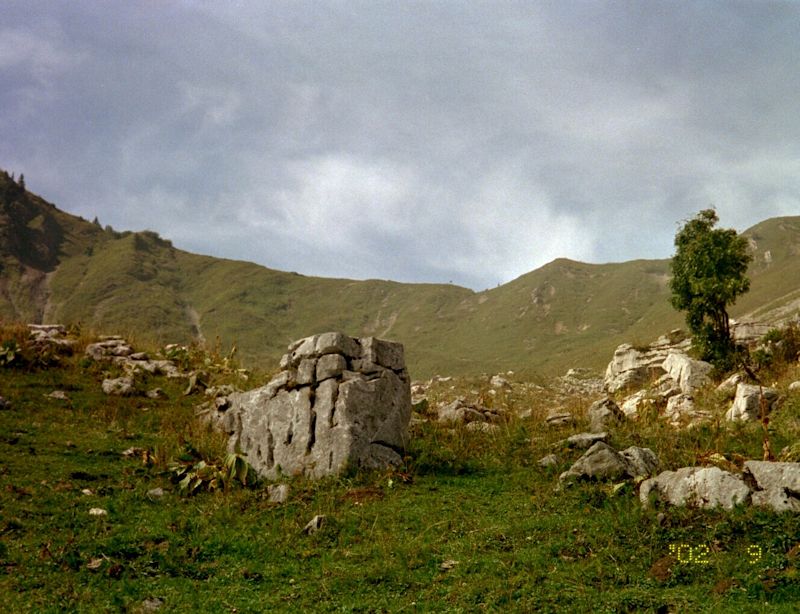
The Dents du Midi (up there in the middle of the cloud),
seen here from La Calaz.
Dr
Peck visits La Calaz briefly.
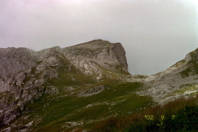
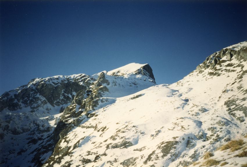
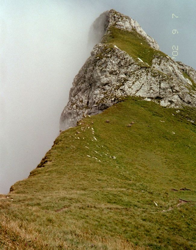
Cornettes
de Bise -- the summit cross is barely visible on the top.

Our little track in the foreground winds around the hillside and then slants upwards to the left over the rocks.
A look back at our track from La Calaz
Dr
Pirri approaches the col near the Chaudin on a day of variable weather.

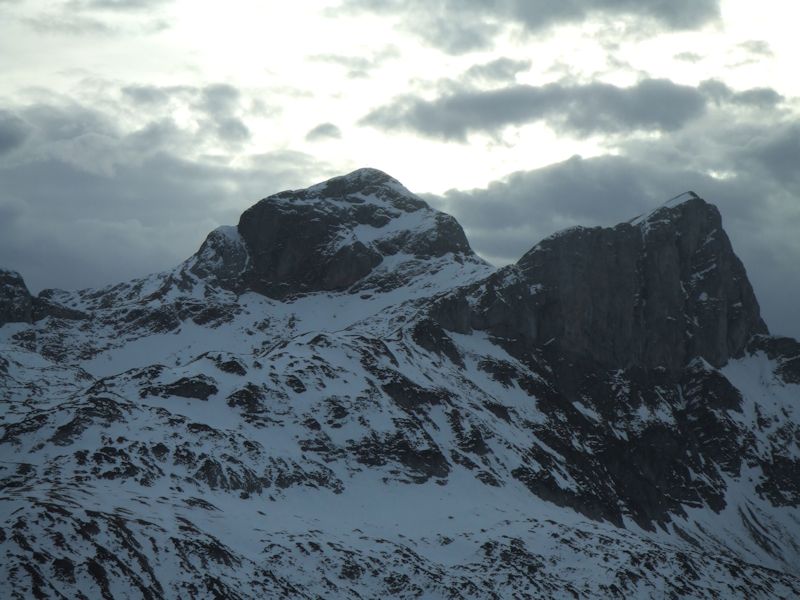
The
col near the Rochers de Chaudin (Cornettes de Bise on the upper left), already
occupied by the Bouquetin Gang of Bise.
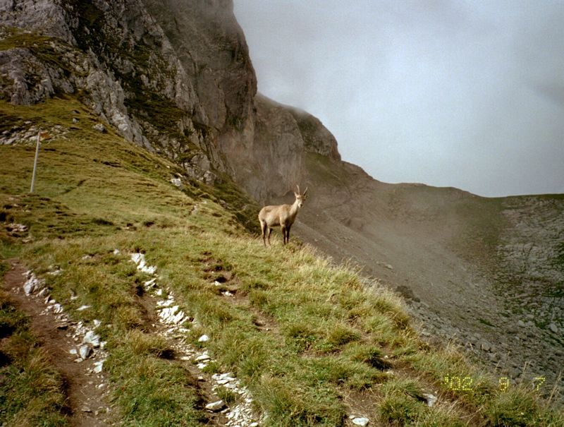
The Bouquetin
Capo warns visitors off his 'turf'.
(The route down to
Loz and Tanay contours awkwardly above the capo's butt down into the scree
on the lower right.)
Chaudin
and bouquetin, looking eastward from the col.
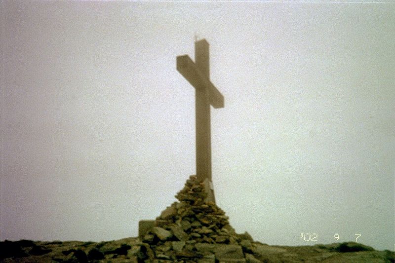
The
summit cross, newly added since our last visit here. Not that much of an improvement,
really. (Nobody ever puts a crescent or an 8-armed elephant-goddess on
top of these peaks.)

A
young lady coming on up towards the top, 7 September 2002, with Dr Pirri somewhere
behind her taking a little nap and with Chaudin behind on the left. The young
lady hit the top, settled in next to the big cross, pulled out a cellphone, and
called all her friends to tell them in a shout that she'd made it to the top.
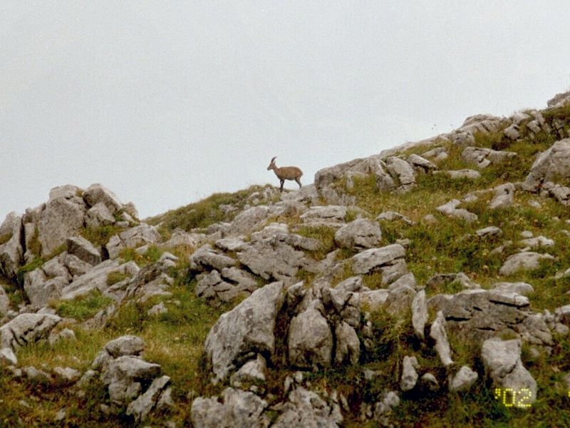
Amidst
a hailstorm whilst descending, here's another friend who's been distracted and
has forgotten what he came here for.

Same
friend, same sudden rain and hailstorm -- which luckily died away ten minutes
later (the storm, not the animal).
The
narrator gazing long upon the Cornettes de Bise from the north, at La Combe above
the Lac de Tanay, November 2006
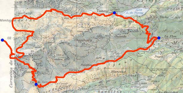
This
map shows one recommended hiking route from the trailhead in the tiny village
of Le Flon (1149m),
along the lower red route up into the Verne valley past the farm Le Coeur at about
1660m, then steeply up to the Col de Verne (1814m),
lower left near the edge of the map.
Hiking
trails can also be seen coming up to the Col de Verne from France to the west,
from way down in the village of Chapelle-d'Abondance (1011m) on the river Dranse, and from the south, along the French frontier, from the other
stations of the ski-complex called Les Portes du Soleil.
The
hike then turns northward up a steep meadow to a small farm La
Calaz (2064m), following the border markers (+++++ on the map), then turns
northwest up into the rocks to a col at the Rochers de Chaudin, and finally (off
the map) straight up to the summit.
On
the map above, the upper red line shows Mr Peck's former running route descending
over the cliffs of Chaudin, then down through a succession
of high bowls of Montagne de l'Au or Loz to the tourist village at the beautiful
lake of Tanay, and back to Le Flon.
 Dwight Peck's personal website