You may not find this terribly rewarding unless you're included here, so this is a good time for casual and random browsers to turn back before they get too caught up in the sweep and majesty of the proceedings and can't let go.
Hunting scenic waterfalls in the wilds of Kentucky

The day looks fine, and hikeworthy, 7 October 2021, and in this photo it might appear that we are setting out on our hike at an early hour. But that's a trick of the lighting, to be honest.

We're trusting our lovely Volvo to the far end of the carpark of the Visitors Centre and traipsing back to cross the river to begin our walk, trembling with enthusiasm. That's the Edward Moss Gatliff Bridge, a very helpful edifice in terms of getting across the Cumberland River.

Edward Moss Gatliff lived in the area from 1887 to 1949, but it's not easy to find out why his name got stuck on the bridge; virtually all mentions of him comfortably found on Google refer only to this bridge. However, the bridge itself must have made life much more pleasant for locals and tourists . . .

. . . as we can see here -- this purports of illustrate how people crossed the river here prior to the construction of the bridge in 1954. (Source)

This is so much more convenient, even if we have to plod all the way across it.

Crossing the fairly broad Cumberland River, which presumably gets even wider over by 'Paducah'.

A zoom of the view upstream, facing east, before it spins around at 'Blue Bend' and runs back upstream to the southwest. We've tried to peer down to see the river bottom, but it seems impossible.

We're off, in a scene that brings to mind early experiences with Ramar of the Jungle (TV 1952-1954, Imdb 7.4) and maybe even Tarzan. [Though Ramsar was filmed in a Hollywood studio, to be honest.]

But the jungle quickly yields to a more familiar Cumberland Falls experience.

The hike we've chosen for today is the first part of the 'Blue Bend Loop' which follows a long-distance through-trail called the Sheltowee Trace over two miles upriver round that sharp bend to meet a certain Trail 10 and continues back over the ridge another 2.3 miles back to the bridge.

We've considered the situation very carefully, and we've reached a consensus that we don't wish to walk an additional 2.3 miles over any jungley ridge, so we will content ourselves with marching about 1.5 miles along the river to the Blue Bend itself, a destination which we hope to recognize by the debouchment of the Bunche Creek on the far side and, of course, by the Bend itself.

Penetrating the forest of rhododendrons -- proliferating at a frightening rate, and toxic for wildlife (we were instructed a bit on this farther along in our journey).

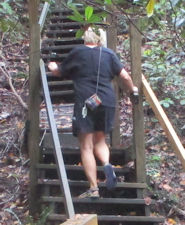
Down into a mushy creek bed, on a strategically placed stairway


It's still a bit jungley along this bit, and mildly claustrophobic.

Someone has thoughtfully chainsawed out all the pesky fallen trees across the path.

The quiet Cumberland flows on.

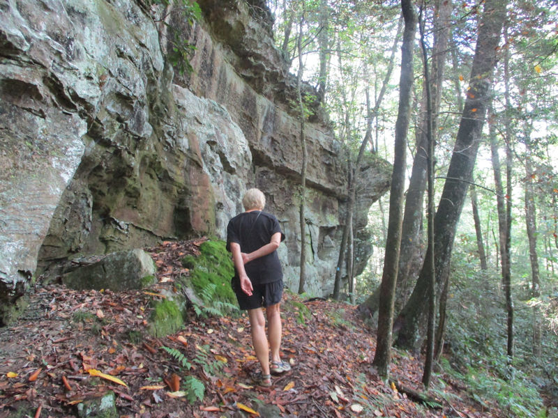
There's a line of monster craggy cliffs that has been following us along up on the right, and now it's beginning to close in.


The serious fun begins.

A bit of an orange-squeezer this, but needs must.

The trick seems to be to exhale deeply and pull your tummy in, and squirm faster.


This is an attractive and easy walk and can be recommended for anyone who doesn't require a wheelchair.

All of these forbidding and unmanageable cliffs and ravines must have played a great role in Kentucky's development as a state.

Less flat space for enormous Amazon 'fulfillment centres', for example. [That turns out to be wildly untrue.]

Inconvenient to be here alone at night without a flashlight

The quiet Cumberland flows on, and on ('Quiet Flows the Cumberland'). We are continuing the eastward trek, but confident that the Bend cannot be too far off now.

More sunlight reaching us now, it seems. Others in our party have mentioned that there is indeed a strong sense that we're going round the bend. The bend in the river, that is.

There is the downstream end of the predicted island which our little map places just 100m past the centre of the bend as it turns sharply back to the southwest.

We're following along looking for Bunches Creek on the far side just after the island.


Could that be it?

Bingo. Bunches Creek, recently nourished by Little Bunches Creek.

So we now have only to retrace our steps.


We're repassing some now familiar stages along the way.

-- Mind your head!


The unofficial botanist in our party is explaining how the rhododendrons, though attractive in blossom, are not always good to have around.

First, they are invasive and will out-compete native shrubs and trees, and can spread quickly (some years ago we saw whole hillsides on the coast of Devon that had been taken over); its foliage can be so thick that nothing can grow underneath, and in any case it can poison the soil and thus badly reduce biodiversity; it's also toxic for mammals and can be deadly for both wildlife and commercially important grazing animals. [For the infestation of Ireland's national parks, read here.]

There sure is a lot of it along this stretch of the path. [BTW, the blue trail blaze signifies the Blue Bend path, and the white diamond blaze is for the 240-mile Sheltowee Trace path of which the Blue Bend is a part.]

Nearing the end of the rhododendron infestation


Back up the Thoughtful Stairs

-- Now what? Who left a great whacking tree down the length of the path? Stop smirking, we can do this.

-- See? Harrowing. But it's done.

The last of the big overhangers


The Edward Moss Gatliff Bridge is now visible through the foliage.

And no waiting for the ferry.

The river, nearly to the lip of the Falls

We later took a little sightseeing drive out westward from the bridge to see what's there, and, basically, there wasn't anything. The next town-ish thing was Honeybee, the post office of which closed down in 1983.

Now for the short recce westward to Honeybee, and then back for a shower and our takeout dinner on the rooftop patio.

Choupette is overjoyed to greet us on our return. On the patio, there was a young family doing their own takeout, and they were disconsolate (the parents, that is) to have just discovered that there are no alcoholic beverages available anywhere here. Except in the back seat of our car, so Kristin gifted them (the parents, that is) with a bunch of tins of Yuengling Traditional Lager.

That's a rainbow seen from our room -- it's a crap photograph but it presents an opportunity to finally mention the second most important selling point for the Cumberland Falls, after the 'Niagara of the South' itself. It's the Moonbow -- the conditions here allow 'light to reflect off the moon to create a rainbow in the dark. This optical phenomenon is known as a moonbow or lunar rainbow. Several factors must come together for the moonbow to appear including specific water temperatures, rising mist, clear skies, water clarity, and particular wind speed and direction. The moonbow can happen two days before, on, or after a full moon.'
This is said to be 'a unique natural phenomenon that is not regularly visible anywhere else in the Western Hemisphere on a predictable schedule during a time period around the Full Moon'. But the Victoria Falls on the Zambezi River are said to have a nice moonbow too.
So there's that.

We've had a fine time here and leave the place a little reluctantly, with a lot of the available trails left unexplored. But we're off . . .

. . . blasting along the highway bound for Wytheville, Virginia, troubled only by our deep sympathies for the stationary vehicles over the past 12 miles in the I-81's westbound lanes.

A slightly truncated scan of the Park's trail map
What's next, then? A look-in at Wytheville for an overnight stage, and then home.
 Dwight Peck's personal website


